Exploring Mussoorie
Area : 65 sq km Altitude : 2005.5 m Climate: Temperature in Summer : 31.2°C(max);7.2°C(min) Temperature in Winter : 7.2°C(max);1.1°C(min) Languages : Hindi and English Best Time to Visit : April-June and September-October
History Of Mussoorie
Popularly known as the Queen of Hills, this charming hill station, 34 kms from Dehradun is situated at an altitude of 2003 mts in the Garhwal hills. above sea-level. Mussoorie is one the beautiful hill stations in India and the most frequently visited. It provides excellent respite to people who want relief from the hot sultry conditions of the plains, especially since it is close enough to the capital to make just weekend trip. Also, major Hindu pilgrimage sites like Kedarna th, Badrinath, Gangotri, Yamunotri, Haridwar, Rishikesh are not far from this place.
In 1820, Captain Young of the British army was influenced by the beauty of this place and made it his residence. The name, Mussoorie is derived from plants of 'Mussoorie' which were found in abundance here. After its discovery, this hill station gradually developed as a centre of education, business, tourism and beauty.
Sightseeing In Mussoorie
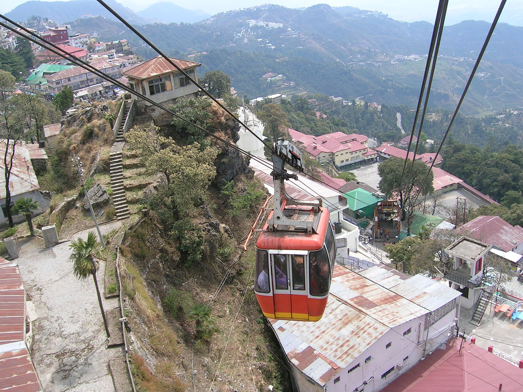
Enjoy a Ropeway ride to the second highest peak of Mussoorie. It can also be negotiated by bridles path which forks-off from Mall Road near Kutchery and to reach takes about twenty minutes. The Ropeway distance is only 400 mtrs. And the sheer thrill of the ride is memorable. Gun Hill offers a beautiful panoramic view of the Himalayan ranges namely Bunderpunch, Srikantha, Pithwara and Gangotri group etc. and a bird's eye view of Mussoorie town and Doon Valley. During pre-independence days a gun mounted on this top used to be fired heralding mid-day to enable people to adjust their watches and hence this name.
A picnic spot having a beautiful garden and an artificial mini lake with boating facilities. It is located at a distance of 4kms by cycle rickshaw, pony or by car and only 2 kms on foot via Waverly Convent Road.
Highest Peak of Mussoorie near Lal Tibba. It is about 5 kms from the Tourist Office and one can go on horse back or on foot. Snow view from this spot is exhilarating.
It starts from Kulri Bazar near Rink Hall and ends at Library Bazar covering a total distance of about 3 kms. The main charm of this froad is horse riding and wlking. Sunset view of the Himalayas is superb. Camel's Rock with a life like resemblace can be seen from the spot near Mussoorie Public school.
8.5 kms from Mussoorie on Mussoorie- Jharipani Road. Visitors can go by bus or by car upto 7 kms to Jharipani from where the fall is 1.5 kms, on foot.
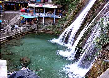
7 kms from Mussoorie on Mussoorie-Dehradun road. Access by car or bus upto Balta village from where the fall is 3kms by car or foot. An ideal spot for bathing anf picnics.
15 kms from Mussoorie on the Yamunotri Road having an altitude of 4500 ft. It has the distinction of being the biggest and prettiest waterfall located in a beautiful valley and is surrounded by high mountains. Bath at the foot of the falls is refresshing and enjoyabled for children and adults alike.
An ancient temple situated on Cart Mackenjie Road and is about 6 kms from Mussoorie. Vehicles can go right upto the spot. It Provies a charming view of Doon Valley as well as of Mussoorie.
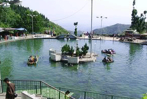
A newly developed picnic spot, situated on Mussoorie- Dehradun road and is about 6 kms from Mussoorie. It is a delightful spot. Pedal boats are availble. It commands an enchanting view of Doon Valley and nearby villages.
At a distance of about 2 kms on Tehri bye pass road, this place is developed as a picnic spot and has a park surrounded with pine forest and flowering shrubs, and is approachable by foot or taxi/car. The main attraction is the wildilife of the park like Ghurar, Kanankar, Himalayan Peacock, Monal etc.
6 kms The Park Estate of sir George Everest, First Surveyor General of India, Who had his offce and residence here, is approachable by road. The highest peak in the world, Mount Everest, is named after him
Plan your visit
A useful journey leaves room for local discoveries. Start with these essentials, then verify operational details from primary sources.
Mountain weather can shift quickly; check forecasts, road access and local advisories.
Plan for hill roads and longer journeys than the map may suggest; use reliable licensed transport.
Explore nearby walks, viewpoints and markets without overloading a single day.
Carry waste out, respect fragile ecosystems and follow any trekking restrictions.
Photos and places to remember
More journeys to discover
Frequently asked questions
What is Mussoorie known for?
Mussoorie is explored in this guide through its local heritage, visitor attractions, culture and images. The highlights and linked articles below offer starting points for your itinerary.
How should I plan a first visit to Mussoorie?
Choose a few nearby highlights in Mussoorie, group them by area and allow flexibility for travel, meals and rest. Confirm the latest access information with official providers.
When is the best time to visit Mussoorie?
The most comfortable time depends on local weather, festivals and your planned activities. Check current seasonal forecasts and any attraction-specific closure notices for Mussoorie.
Where can I confirm ticket prices and opening times in Mussoorie?
Check the official tourism authority or the individual venue before departure. This page intentionally does not repeat potentially outdated prices or hours.
Is this Mussoorie guide updated?
This page was rebuilt from legacy IndiaCityTrip content on October 23, 2026. Older descriptive material has been reorganized; operational details still require direct verification.